Vue d'ensemble
Applications logicielles BIM pour la topographie, la conception d'infrastructures et les constructionsSierraSoft Survey
Logiciel BIM pour le calcul et la compensation des mesures topographiquesSierraSoft Land
Logiciel BIM pour la modélisation 3D et l'analyse du territoireSierraSoft Hydro
Logiciel BIM pour la conception hydrauliqueSierraSoft Roads
Logiciel BIM pour la conception de routes et d'autoroutesSierraSoft Rails
Logiciel BIM pour la conception de voies ferréeSierraSoft Land Design Studio
Logiciel BIM pour le calcul, la modélisation 3D et l'analyse topographiqueSierraSoft Roads Design Studio
Logiciel BIM pour la conception de route et hydrauliqueSierraSoft Rails Design Studio
Logiciel BIM pour la conception de voies ferrée et de routesSierraSoft Infra Design Studio
Logiciel BIM pour la conception de voies ferrée, de routes et hydrauliqueVue d'ensemble
Vue d'ensemble des services offertsSubscription
Caractéristiques de l'abonnementCodes d'activation
Demande de codes d'activation de produit et de version d'essaiSupport technique
Caractéristiques du serviceDemande de support technique
Service client
Service clients sur les commandes, les factures, les licences et les produits sans SubscriptionSierraSoft Training
Live and deferred online coursesSierraSoft Coaching
Service de mentorat personnalisé à distanceSierraSoft Consulting
Conseil technique lié à la mise en service et à l’utilisation des solutions SierraSoftBIM Accelerator
Consulting and support service in the implementation of the BIM methodologyCertification Expert BIM
Certifiez vos compétences professionnellesSierraSoft Education
Complete your university education with knowledge and skills about SierraSoft productsVue d'ensemble
Qui sommes-nous
Informations sur SierraSoftContacts
Adresses, contacts et réseau de venteNouvelles et Bulletins d'information
Dernières nouvelles de SierraSoftÉvénements en présence
All information about upcoming in-person eventsEvents “Online - Live”
All information about upcoming “Online - Live” eventsVue d'ensemble
Nouvelles principales
Caractéristiques
Courses
The course is designed to allow a constant and flexible participation of professionals who already work, or who intend to work, in the field of land survey restitution and analysis.Ressources
Demo
Overview of the functions for traditional and BIM land survey restitution using the SierraSoft Land software.Essayez-le
Téléchargez la version d'essai maintenant et testez sa puissance!Achetez-le
Licence perpétuelle ou temporaire... il y a une solution pour tout le monde!SierraSoft Land
Logiciel BIM pour la modélisation 3D et l'analyse du territoire
Ressources techniques
Accessible à partir de l'aide en ligne du logiciel (y compris la version d'essai)Documentation:
Vidéo tutorial:
Introduction à l'environnement de travail
Vidéo tutorial:
Présentation des bases de données
Vidéo
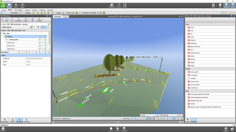
Traditional land restitution and BIM with SierraSoft Land
Example of automatic BIM restitution of a survey using codes assigned in the field during measurement (vidéo en anglais)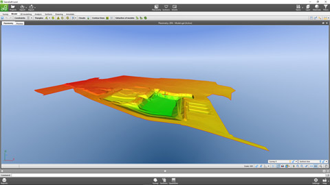
Modeling and BIM quantity with SierraSoft Land
Modeling example, sections extracting and quantities calculation (vidéo en anglais)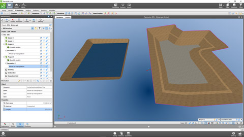
3D design in BIM with SierraSoft Land
Example of 3D design with smartpolyline, quantities calculation and models merging (vidéo en anglais)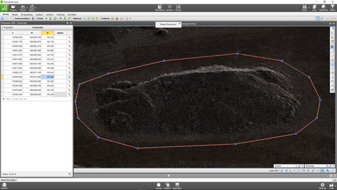
Point clouds management with SierraSoft Land
Example of modeling and quantities calculation on point clouds (vidéo en anglais)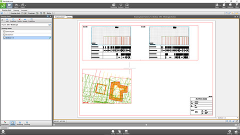
Final drawings in BIM with SierraSoft Land
Data printouts and management of annotations boxes and sheets for the creation of final drawings with the link to the project information model (vidéo en anglais)