Vídeo sobre BIM para la topografía, el proyecto de infraestructuras y las construcciones
SierraSoft es una empresa especializada en el desarrollo y suministro de software BIM para la topografía y el proyecto de infraestructuras
Vídeo sobre BIM para topografía, Vídeo sobre BIM para el proyecto de ferrocarriles, carreteras y hidráulica, Software BIM para la construcción
Vídeo sobre BIM para ingeniería civil, Vídeo sobre BIM para infraestructuras, Vídeo sobre BIM para topografía
Vídeo SierraSoft
Vídeo sobre BIM para la topografía, el proyecto de infraestructuras y las construcciones
BIM para la topografía e las infraestructuras
La metodología del Building Information Modeling aplicada a la topografía y a las infraestructuras de transporte
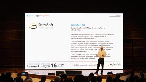
infraBIM: maturità e stato dell'arte
Keynote by Mauro Coletto (CEO of SierraSoft) at the 9th IBIMI National Conference - buildingSMART Italia
Mira el video >
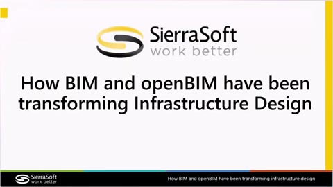
How BIM and openBIM have been transforming Infrastructure Design
Speech by Mauro Coletto (CEO of SierraSoft) at the buildingSMART International Standards Summit – Berlin 2025
Mira el video >
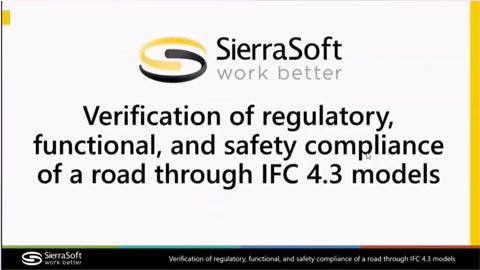
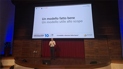
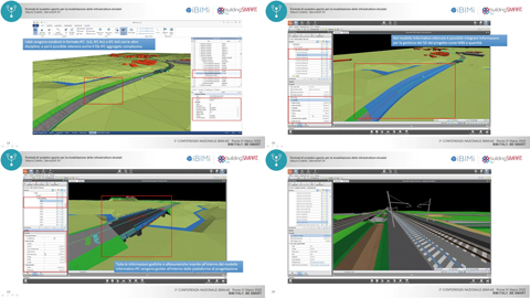
Verification of regulatory, functional, and safety compliance of a road through IFC 4.3 models
Speech by Mauro Coletto (CEO of SierraSoft) at the buildingSMART International Standards Summit – Berlin 2025
Mira el video >
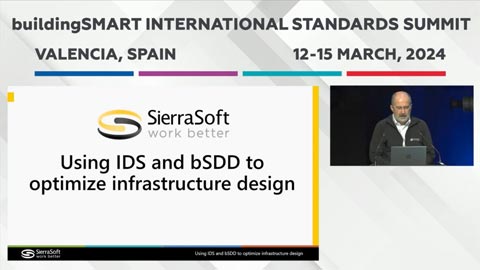
Using IDS and bSDD to optimize infrastructure design
Speech by Mauro Coletto (CEO of SierraSoft) at the buildingSMART International Standards Summit – Valencia 2024
Mira el video >
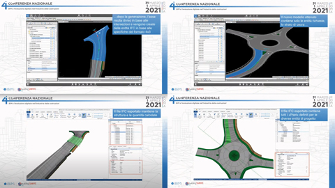
Validazione delle infrastrutture stradali utilizzando il formato IFC 4.3
Keynote by Mauro Coletto (CEO of SierraSoft) at the 8th IBIMI National Conference - buildingSMART Italia
Mira el video >
Verification of regulatory, functional, and safety compliance of a road through IFC 4.3 models
Speech by Mauro Coletto (CEO of SierraSoft) at the buildingSMART International Standards Summit – Berlin 2025
Mira el video >
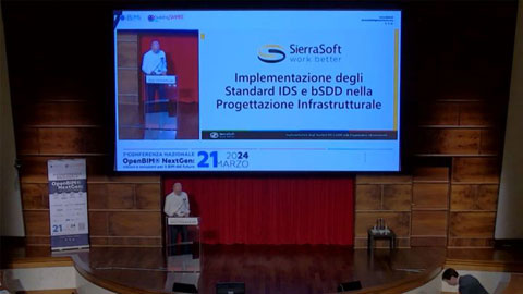
Implementazione degli Standard IDS e bSDD nella Progettazione Infrastrutturale
Discurso de Mauro Coletto (CEO de SierraSoft) en la 7° Conferenza Nazionale IBIMI - buildingSMART Italia
Mira el video >
InfraBIM with openBIM is already here
Speech by Mauro Coletto (SierraSoft) at the buildingSMART International Standards Summit in Rome - 2023
Mira el video >
Purpose Useful Models with SierraSoft BIM Modeling
Example of using BIM filters to obtain information models according to purpose (video en inglés)
Mira el video >
Information exchange of quantities from models with SierraSoft BIM Modeling
Example of exporting quantities in the BIM model (video en inglés)
Mira el video >
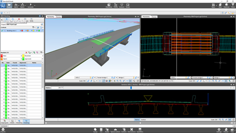
Information exchange of a structure with SierraSoft BIM Exchange and SierraSoft BIM Checking
Example of an operational flow for inserting a bridge into the design (video en inglés)
Mira el video >
Information exchange of a survey with SierraSoft BIM Exchange and SierraSoft BIM Checking
Example of operational flow between a BIM survey and design (video en inglés)
Mira el video >
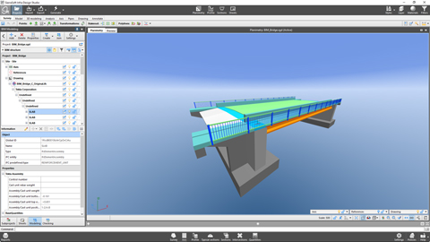
BIM object remapping with SierraSoft BIM Modeling
Example of remapping a bridge (video en inglés)
Mira el video >
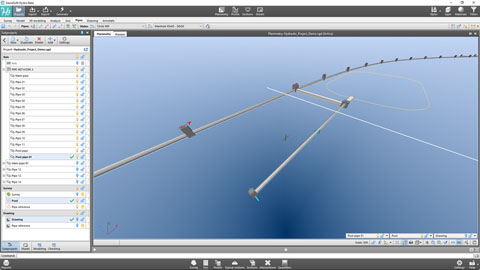
Production of the information model of a pipe network with SierraSoft BIM Modeling
Example of creating an information model of a pipe network (video en inglés)
Mira el video >
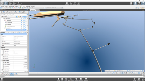
Production of a railway information model with SierraSoft BIM Modeling
Example of creating an information model of a railway (video en inglés)
Mira el video >
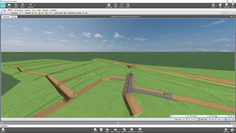
Production of a road information model with SierraSoft BIM Modeling
Example of creating an information model of a road (video en inglés)
Mira el video >
Production of a map information model with SierraSoft BIM Modeling
Example of creating an information model starting from a drawing map (video en inglés)
Mira el video >
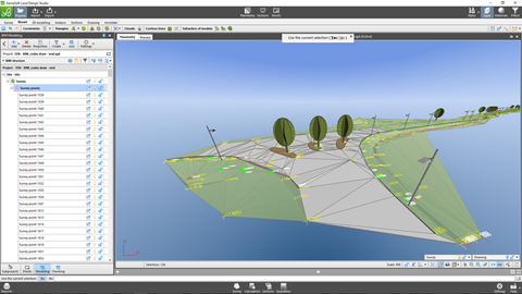
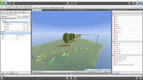
Production of a survey information model with SierraSoft BIM Modeling
Example of creating a survey information model (video en inglés)
Mira el video >
The road and railway infrastructure designer in BIM: evolution of a profession
Speech by Mauro Coletto (SierraSoft) - ASSOBIM Talks of 18 may 2023
Mira el video >
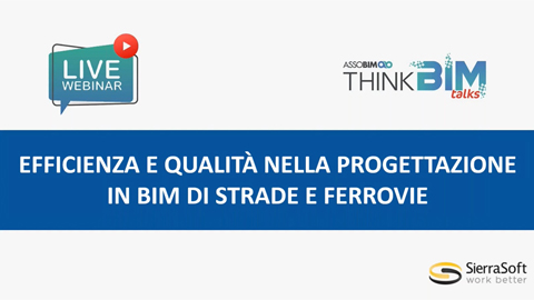
Efficiency and quality in BIM design of roads and railways
Speech by Mauro Coletto (SierraSoft) - ASSOBIM Talks of 14 December 2022 (video en italiano)
Mira el video >
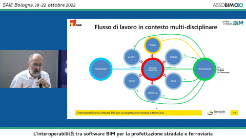
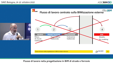
Interoperabilidad entre el software BIM para el proyecto de carreteras y ferrocarriles
Ponencia de Mauro Coletto (SierraSoft) - Digitization Village by Assobim - SAIE 2022 (video en italiano)
Mira el video >
Flujo de trabajo en el proyecto BIM de carreteras y ferrocarriles
Ponencia de Mauro Coletto (SierraSoft) - Digitization Village by Assobim - SAIE 2022 (video en italiano)
Mira el video >
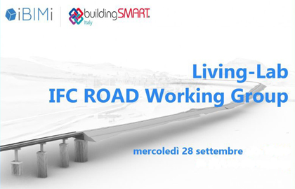
Living-Lab Grupo de trabajo IFC Road
Presentación de la “Guida all'IFC per il progetto stradale” resultante de las actividades del grupo de trabajo IFC Road de IBIMI - buildingSMART Italia (video en italiano)
Mira el video >
Modelado de información de carreteras y ferrocarriles en IFC con SierraSoft Infra Design Studio
Speech by Mauro Coletto (SierraSoft) during the 5th National Conference of IBIMI - buildingSMART Italia (video en italiano)
Mira el video >
El proyecto de infraestructuras viarias con IFC
Speech by Mauro Coletto (SierraSoft) during the 4th National Conference of IBIMI - buildingSMART Italia (video en italiano)
Mira el video >
Open exchange formats for road infrastructure modeling
Speech by Mauro Coletto (SierraSoft) during the 3rd National Conference of IBIMI - buildingSMART Italia (video en italiano)
Mira el video >
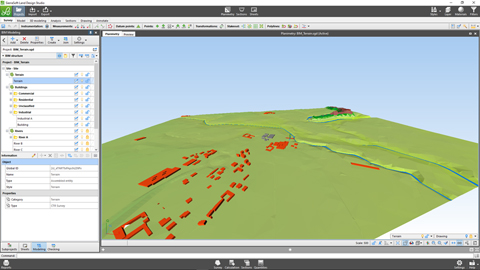
Software BIM para el modelado 3D y el análisis del territorio
SierraSoft Land es un software BIM para el modelado 3D y el análisis del territorio a partir de puntos levantados con estación total, GPS, escáner láser, drones.
Restitución topográfica tradicional y BIM con SierraSoft Land
Example of automatic BIM restitution of a survey using codes assigned in the field during measurement (video en inglés)
Mira el video >
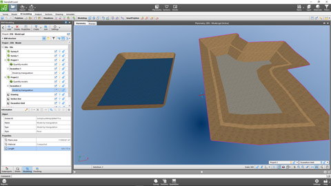
Modelado y cantidades en BIM con SierraSoft Land
Ejemplo de modelado, extracción de secciones y cálculo de cantidades (video en inglés)
Mira el video >
3D design in BIM with SierraSoft Land
Example of 3D design with smartpolyline, quantities calculation and models merging (video en inglés)
Mira el video >
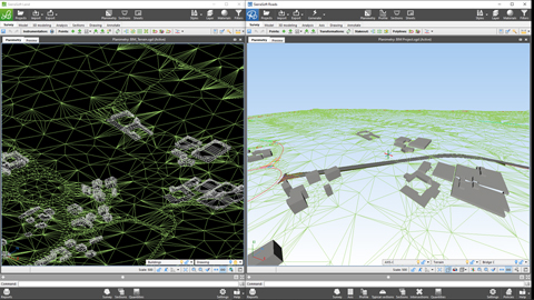
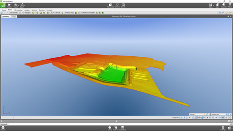
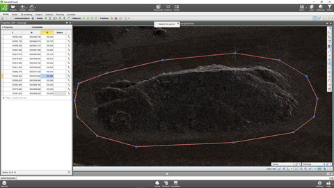
Gestión de nubes de puntos con SierraSoft Land
Example of modeling and quantities calculation on point clouds (video en inglés)
Mira el video >
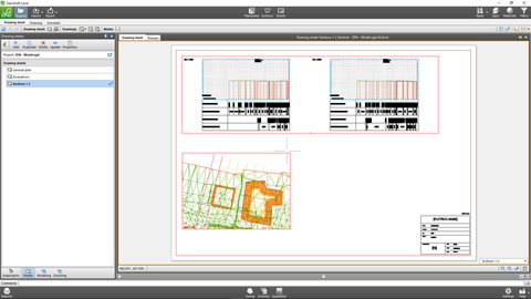
Dibujos finales en BIM con SierraSoft Land
Data printouts and management of annotations boxes and sheets for the creation of final drawings with the link to the project information model (video en inglés)
Mira el video >
Software BIM para el proyecto de hidráulica
SierraSoft Hydro es un software BIM para el proyecto hidráulico de vías fluviales, canales, zanjas, tuberías, redes de tuberías y pozos.
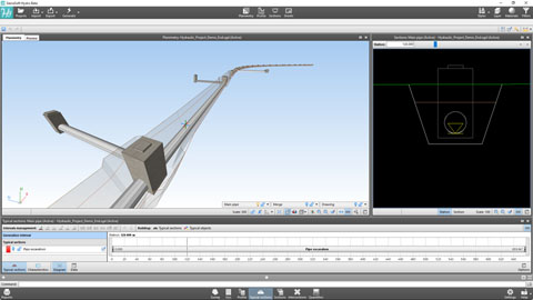
Hydraulic BIM design of a pipe with SierraSoft Hydro
Example of designing a hydraulic pipe below a road (video en inglés)
Mira el video >
Pipes networks with SierraSoft Hydro
Example of creating a pipes network and automatic numbering management (video en inglés)
Mira el video >
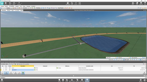
BIM design of canals with SierraSoft Hydro
Example of creating a new canal (video en inglés)
Mira el video >
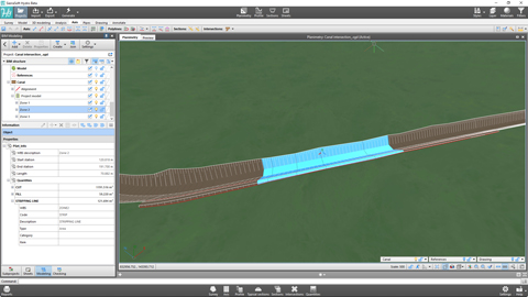
Canals and intersections customizations with SierraSoft Hydro
Examples of point changes to the canal axis and management of intersections with a network of existing canals. (video en inglés)
Mira el video >
Quantities calculation in BIM with SierraSoft Hydro
Examples of quantities calculation for sections, on models and by entities with information model creation (video en inglés)
Mira el video >
Final drawings in BIM with SierraSoft Hydro
Data printouts and management of annotations boxes and sheets for the creation of final drawings with the link to the project information model (video en inglés)
Mira el video >
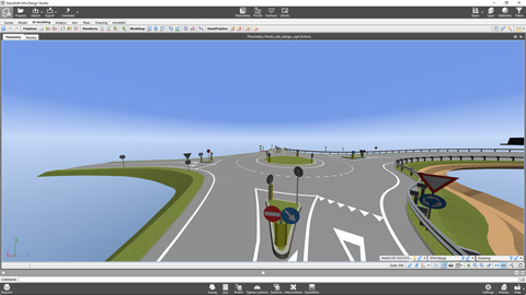
Software BIM para el proyecto de carreteras y autopistas
SierraSoft Roads es un software BIM para el proyecto de infraestructuras viales: carreteras, autopistas, glorietas, intercambiadores, intersecciones, carriles de entrada y salida.
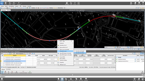
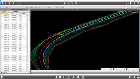
Designing of a road alignment according to the policy with SierraSoft Roads
Example of alignment design of an axis according to the policy (video en inglés)
Mira el video >
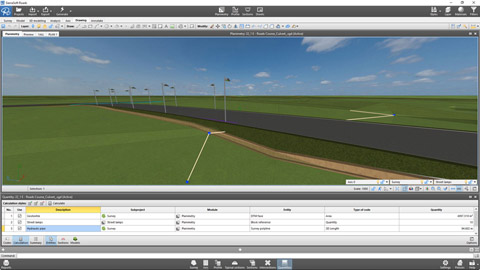
Axis generation and results with SierraSoft Roads
Example of axis generation to obtain the project planimetry, road model, sections, quantities and information model (video en inglés)
Mira el video >
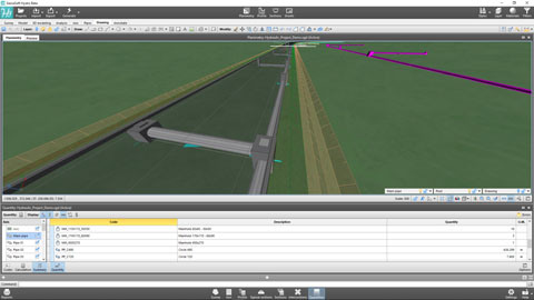
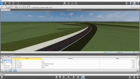
Quantities calculation in BIM with SierraSoft Roads
Examples of quantities calculation for sections, on models and by entities with information model creation (video en inglés)
Mira el video >
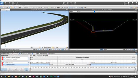
Customizing the alignment with SierraSoft Roads
Examples of modifications in specific axis points with typical sections, typical section characteristics, axis and profile polylines (video en inglés)
Mira el video >
3D design in BIM with SierraSoft Roads
Example of 3D design with SmartPolyline and creation of the final model (video en inglés)
Mira el video >
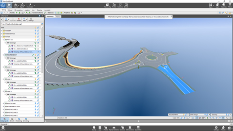
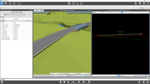
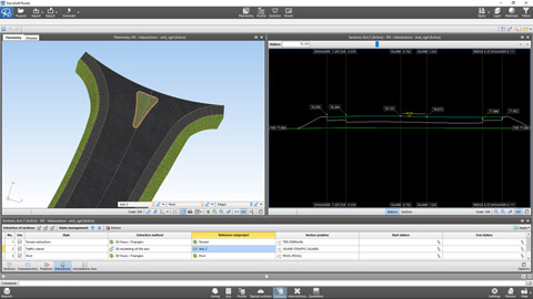
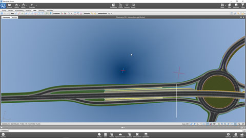
Managing intersections in BIM with SierraSoft Roads
Example of management of at-grade intersections, at-grade roundabout and entry/exit lane (video en inglés)
Mira el video >
Final drawings in BIM with SierraSoft Roads
Data printouts and management of annotations boxes and sheets for the creation of final drawings with the link to the project information model (video en inglés)
Mira el video >
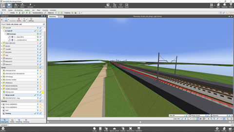
Software BIM para el proyecto de ferrocarriles
SierraSoft Rails es un software BIM para el proyecto de infraestructuras ferroviarias de baja y alta velocidad, de vía única y doble.
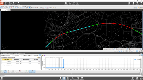
Designing of a railway alignment according to the policy with SierraSoft Rails
Example of alignment design of an axis according to the policy (video en inglés)
Mira el video >
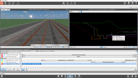
Axis generation and results with SierraSoft Rails
Example of axis generation to obtain the project planimetry, railway model, sections, quantities and information model (video en inglés)
Mira el video >
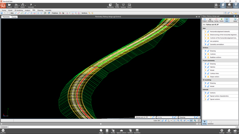
Customizing the alignment with SierraSoft Rails
Examples of modifications in specific axis points with typical sections, typical section characteristics, axis and profile polylines (video en inglés)
Mira el video >
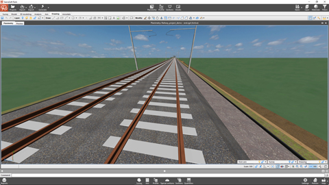
3D design in BIM with SierraSoft Rails
Example of 3D design with SmartPolyline and creation of the final model (video en inglés)
Mira el video >
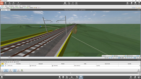
Quantities calculation in BIM with SierraSoft Rails
Examples of quantities calculation for sections, on models and by entities with information model creation (video en inglés)
Mira el video >
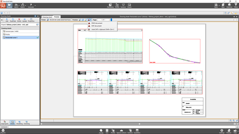
Final drawings in BIM with SierraSoft Rails
Data printouts and management of annotations boxes and sheets for the creation of final drawings with the link to the project information model (video en inglés)
Mira el video >