Video on BIM for land surveying, infrastructure design and construction
SierraSoft is a company specialized in the development and provision of BIM software for land surveying and infrastructure design
Video on BIM for land surveying, Video on BIM for railway, road and hydraulic design, BIM software for construction
Video on BIM for civil engineering, Video on BIM for infrastructure, Video on BIM for land surveying
Video SierraSoft
Video on BIM for land surveying, infrastructure design and construction
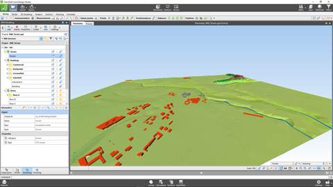
BIM for land surveying and infrastructures
Building Information Modeling methodology applied to land surveying and transportation infrastructures
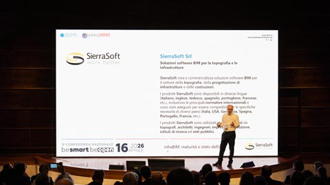
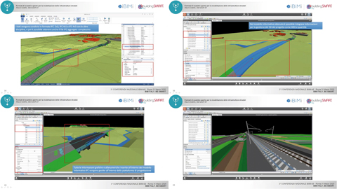
infraBIM: maturità e stato dell'arte
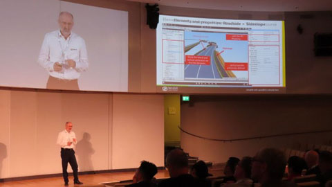
Keynote by Mauro Coletto (CEO of SierraSoft) at the 9th IBIMI National Conference - buildingSMART Italia
Watch the video >
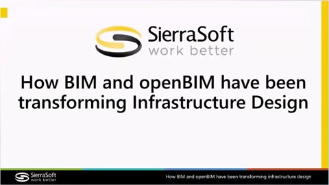
How BIM and openBIM have been transforming Infrastructure Design
Speech by Mauro Coletto (CEO of SierraSoft) at the buildingSMART International Standards Summit – Berlin 2025
Watch the video >
Verification of regulatory, functional, and safety compliance of a road through IFC 4.3 models
Speech by Mauro Coletto (CEO of SierraSoft) at the buildingSMART International Standards Summit – Berlin 2025
Watch the video >
Using IDS and bSDD to optimize infrastructure design
Speech by Mauro Coletto (CEO of SierraSoft) at the buildingSMART International Standards Summit – Valencia 2024
Watch the video >
Validazione delle infrastrutture stradali utilizzando il formato IFC 4.3
Keynote by Mauro Coletto (CEO of SierraSoft) at the 8th IBIMI National Conference - buildingSMART Italia
Watch the video >
Verification of regulatory, functional, and safety compliance of a road through IFC 4.3 models
Speech by Mauro Coletto (CEO of SierraSoft) at the buildingSMART International Standards Summit – Berlin 2025
Watch the video >
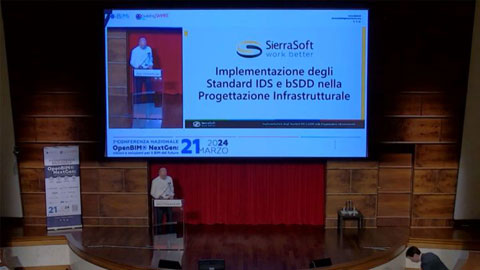
Implementazione degli Standard IDS e bSDD nella Progettazione Infrastrutturale
Keynote by Mauro Coletto (CEO of SierraSoft) at the 7th IBIMI National Conference - buildingSMART Italia
Watch the video >
InfraBIM with openBIM is already here
Speech by Mauro Coletto (SierraSoft) at the buildingSMART International Standards Summit in Rome - 2023
Watch the video >
Purpose Useful Models with SierraSoft BIM Modeling
Example of using BIM filters to obtain information models according to purpose
Watch the video >
Information exchange of quantities from models with SierraSoft BIM Modeling
Example of exporting quantities in the BIM model
Watch the video >
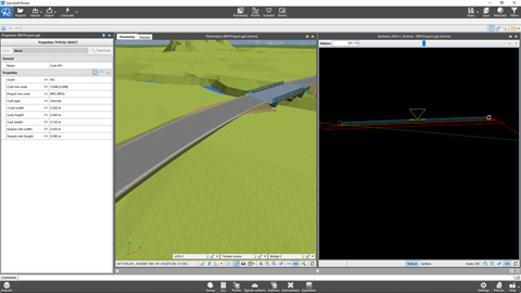
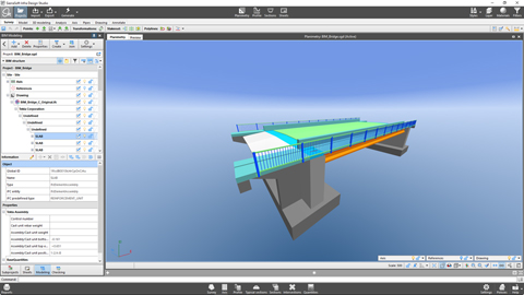
Information exchange of a structure with SierraSoft BIM Exchange and SierraSoft BIM Checking
Example of an operational flow for inserting a bridge into the design
Watch the video >
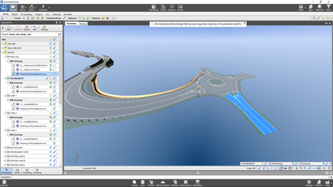
Information exchange of a survey with SierraSoft BIM Exchange and SierraSoft BIM Checking
Example of operational flow between a BIM survey and design
Watch the video >
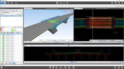
BIM object remapping with SierraSoft BIM Modeling
Example of remapping a bridge
Watch the video >
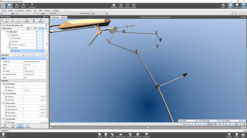
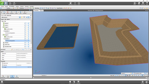
Production of the information model of a pipe network with SierraSoft BIM Modeling
Example of creating an information model of a pipe network
Watch the video >
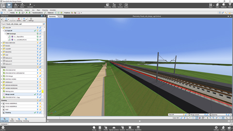
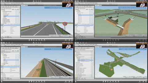
Production of a railway information model with SierraSoft BIM Modeling
Example of creating an information model of a railway
Watch the video >
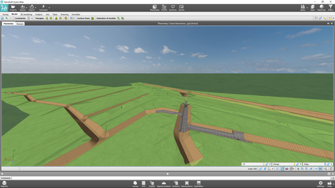
Production of a road information model with SierraSoft BIM Modeling
Example of creating an information model of a road
Watch the video >
Production of a map information model with SierraSoft BIM Modeling
Example of creating an information model starting from a drawing map
Watch the video >
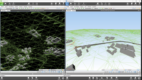
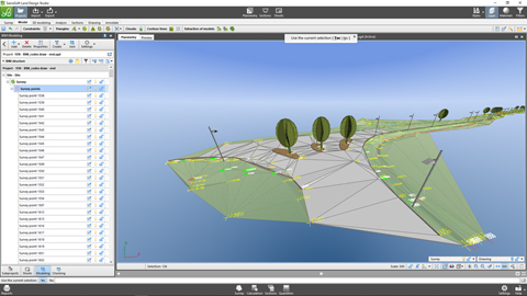
Production of a survey information model with SierraSoft BIM Modeling
Example of creating a survey information model
Watch the video >
The road and railway infrastructure designer in BIM: evolution of a profession
Speech by Mauro Coletto (SierraSoft) - ASSOBIM Talks of 18 may 2023
Watch the video >
Efficiency and quality in BIM design of roads and railways
Speech by Mauro Coletto (SierraSoft) - ASSOBIM Talks of 14 December 2022 (video in Italian)
Watch the video >
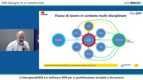
Interoperability between BIM software for road and railway design
Speech by Mauro Coletto (SierraSoft) - Digitization Village by Assobim - SAIE 2022 (video in Italian)
Watch the video >
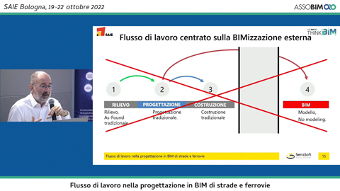
BIM workflow in the design of roads and railways
Speech by Mauro Coletto (SierraSoft) - Digitization Village by Assobim - SAIE 2022 (video in Italian)
Watch the video >
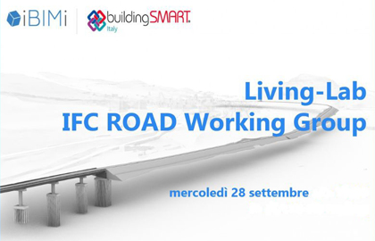
Living-Lab IFC Road Working Group
Presentation of the “Guida all'IFC per il progetto stradale” resulting from the activities of the IFC Road working group of IBIMI - buildingSMART Italia (video in Italian)
Watch the video >
Information modeling of roads and railways in IFC with SierraSoft Infra Design Studio
Speech by Mauro Coletto (SierraSoft) during the 5th National Conference of IBIMI - buildingSMART Italia (video in Italian)
Watch the video >
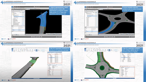
The design of road infrastructure with IFC
Speech by Mauro Coletto (SierraSoft) during the 4th National Conference of IBIMI - buildingSMART Italia (video in Italian)
Watch the video >
Open exchange formats for road infrastructure modeling
Speech by Mauro Coletto (SierraSoft) during the 3rd National Conference of IBIMI - buildingSMART Italia (video in Italian)
Watch the video >
BIM software for land 3D modeling and analysis
SierraSoft Land is a BIM software for land 3D modeling and analysis from points surveyed with a total station, GPS, laser scanners, drones.
Traditional land restitution and BIM with SierraSoft Land
Example of automatic BIM restitution of a survey using codes assigned in the field during measurement
Watch the video >
Modeling and BIM quantity with SierraSoft Land
Modeling example, sections extracting and quantities calculation
Watch the video >
3D design in BIM with SierraSoft Land
Example of 3D design with smartpolyline, quantities calculation and models merging
Watch the video >
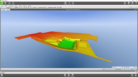
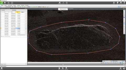
Point clouds management with SierraSoft Land
Example of modeling and quantities calculation on point clouds
Watch the video >
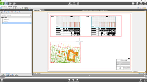
Final drawings in BIM with SierraSoft Land
Data printouts and management of annotations boxes and sheets for the creation of final drawings with the link to the project information model
Watch the video >
BIM software for hydraulic design
SierraSoft Hydro is a BIM software for hydraulic design of waterways, canals, ditches, pipes, pipe networks and manholes.
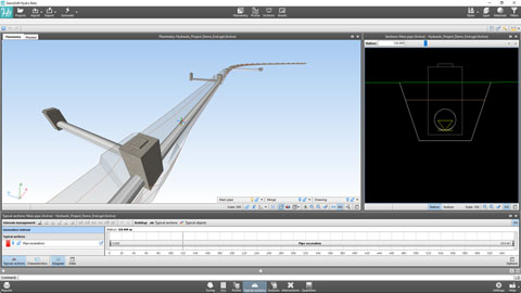
Hydraulic BIM design of a pipe with SierraSoft Hydro
Example of designing a hydraulic pipe below a road
Watch the video >
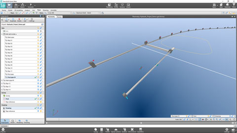
Pipes networks with SierraSoft Hydro
Example of creating a pipes network and automatic numbering management
Watch the video >
BIM design of canals with SierraSoft Hydro
Example of creating a new canal
Watch the video >
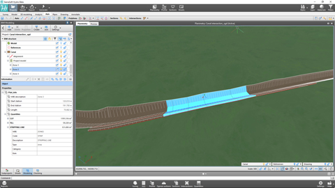
Canals and intersections customizations with SierraSoft Hydro
Examples of point changes to the canal axis and management of intersections with a network of existing canals.
Watch the video >
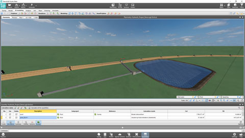
Quantities calculation in BIM with SierraSoft Hydro
Examples of quantities calculation for sections, on models and by entities with information model creation
Watch the video >
Final drawings in BIM with SierraSoft Hydro
Data printouts and management of annotations boxes and sheets for the creation of final drawings with the link to the project information model
Watch the video >
BIM software for the design of roads and highways
SierraSoft Roads is a BIM software for the design of road infrastructure: roads, highways, roundabout, junction, intersection, entry/exit lane.
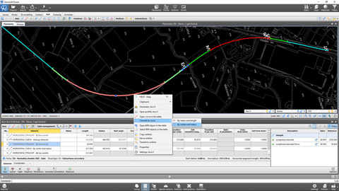
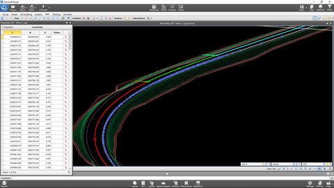
Designing of a road alignment according to the policy with SierraSoft Roads
Example of alignment design of an axis according to the policy
Watch the video >
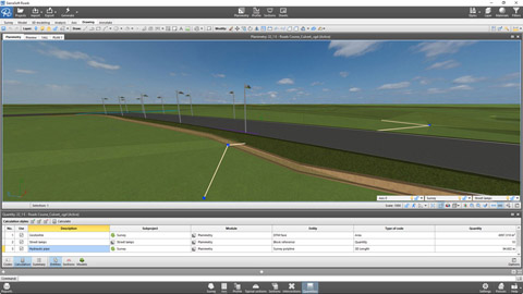
Axis generation and results with SierraSoft Roads
Example of axis generation to obtain the project planimetry, road model, sections, quantities and information model
Watch the video >
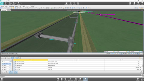
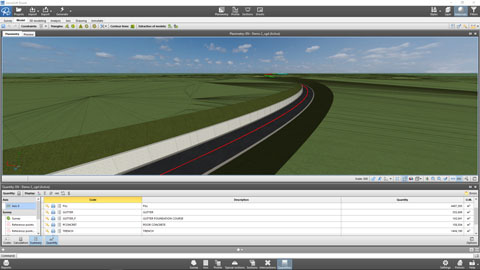
Quantities calculation in BIM with SierraSoft Roads
Examples of quantities calculation for sections, on models and by entities with information model creation
Watch the video >
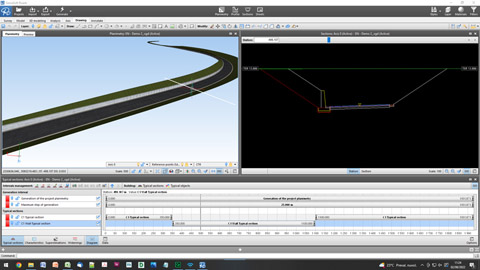
Customizing the alignment with SierraSoft Roads
Examples of modifications in specific axis points with typical sections, typical section characteristics, axis and profile polylines
Watch the video >
3D design in BIM with SierraSoft Roads
Example of 3D design with SmartPolyline and creation of the final model
Watch the video >
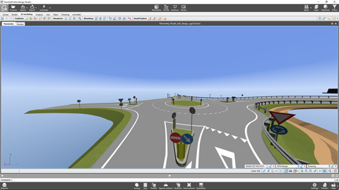
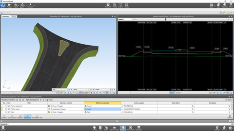
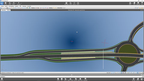
Managing intersections in BIM with SierraSoft Roads
Example of management of at-grade intersections, at-grade roundabout and entry/exit lane
Watch the video >
Final drawings in BIM with SierraSoft Roads
Data printouts and management of annotations boxes and sheets for the creation of final drawings with the link to the project information model
Watch the video >
BIM software for railway design
SierraSoft Rails is a BIM software for the design of railway infrastructure for low and high speed, single and double track.
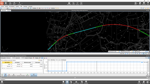
Designing of a railway alignment according to the policy with SierraSoft Rails
Example of alignment design of an axis according to the policy
Watch the video >
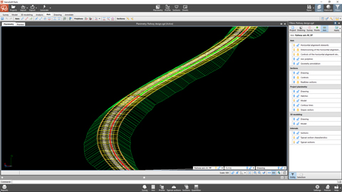
Axis generation and results with SierraSoft Rails
Example of axis generation to obtain the project planimetry, railway model, sections, quantities and information model
Watch the video >
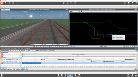
Customizing the alignment with SierraSoft Rails
Examples of modifications in specific axis points with typical sections, typical section characteristics, axis and profile polylines
Watch the video >
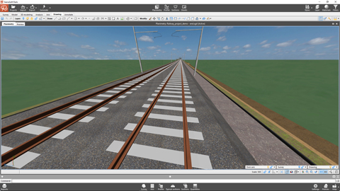
3D design in BIM with SierraSoft Rails
Example of 3D design with SmartPolyline and creation of the final model
Watch the video >
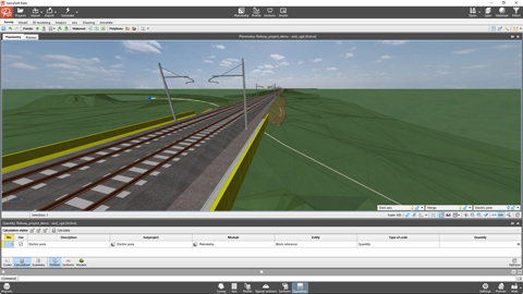
Quantities calculation in BIM with SierraSoft Rails
Examples of quantities calculation for sections, on models and by entities with information model creation
Watch the video >
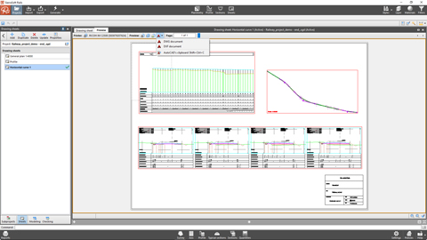
Final drawings in BIM with SierraSoft Rails
Data printouts and management of annotations boxes and sheets for the creation of final drawings with the link to the project information model
Watch the video >