Vidéo sur le BIM pour la topographie, la conception d'infrastructures et les constructions
SierraSoft est une entreprise spécialisée dans le développement et la fourniture de logiciels BIM pour la topographie et la conception d'infrastructures
Vidéo sur le BIM pour la topographie, Vidéo sur le BIM pour la conception de voies ferrée, de routes et hydraulique, Logiciel BIM pour la construction
Vidéo sur le BIM pour le génie civil, Vidéo sur le BIM pour les infrastructures, Vidéo sur le BIM pour la topographie
Vidéo SierraSoft
Vidéo sur le BIM pour la topographie, la conception d'infrastructures et les constructions
BIM pour la topographie et les infrastructures
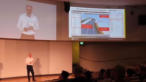
La méthodologie du Building Information Modeling appliquée à la topographie et aux infrastructures de transport
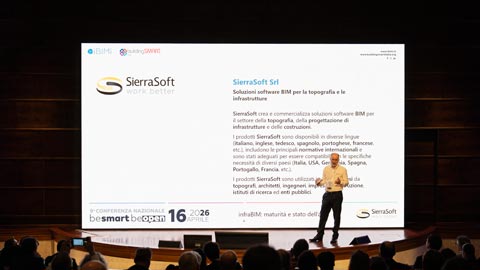
infraBIM: maturità e stato dell'arte
Keynote by Mauro Coletto (CEO of SierraSoft) at the 9th IBIMI National Conference - buildingSMART Italia
Voir la vidéo >
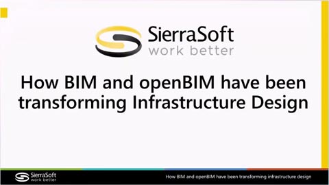
How BIM and openBIM have been transforming Infrastructure Design
Speech by Mauro Coletto (CEO of SierraSoft) at the buildingSMART International Standards Summit – Berlin 2025
Voir la vidéo >
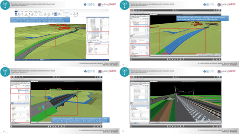
Verification of regulatory, functional, and safety compliance of a road through IFC 4.3 models
Speech by Mauro Coletto (CEO of SierraSoft) at the buildingSMART International Standards Summit – Berlin 2025
Voir la vidéo >
Using IDS and bSDD to optimize infrastructure design
Speech by Mauro Coletto (CEO of SierraSoft) at the buildingSMART International Standards Summit – Valencia 2024
Voir la vidéo >
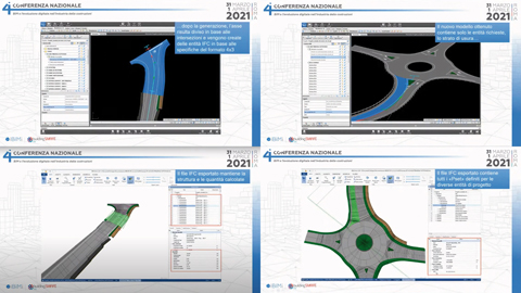
Validazione delle infrastrutture stradali utilizzando il formato IFC 4.3
Keynote by Mauro Coletto (CEO of SierraSoft) at the 8th IBIMI National Conference - buildingSMART Italia
Voir la vidéo >
Verification of regulatory, functional, and safety compliance of a road through IFC 4.3 models
Speech by Mauro Coletto (CEO of SierraSoft) at the buildingSMART International Standards Summit – Berlin 2025
Voir la vidéo >
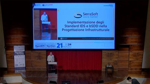
Implementazione degli Standard IDS e bSDD nella Progettazione Infrastrutturale
Keynote de Mauro Coletto (CEO de SierraSoft) à la 7° Conferenza Nazionale IBIMI - buildingSMART Italia
Voir la vidéo >
InfraBIM with openBIM is already here
Speech by Mauro Coletto (SierraSoft) at the buildingSMART International Standards Summit in Rome - 2023
Voir la vidéo >
Purpose Useful Models with SierraSoft BIM Modeling
Example of using BIM filters to obtain information models according to purpose (vidéo en anglais)
Voir la vidéo >
Information exchange of quantities from models with SierraSoft BIM Modeling
Example of exporting quantities in the BIM model (vidéo en anglais)
Voir la vidéo >
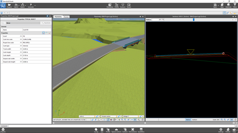
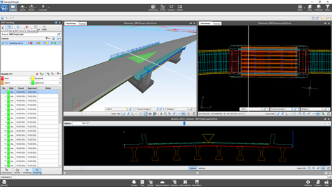
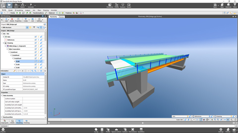
Information exchange of a structure with SierraSoft BIM Exchange and SierraSoft BIM Checking
Example of an operational flow for inserting a bridge into the design (vidéo en anglais)
Voir la vidéo >
Information exchange of a survey with SierraSoft BIM Exchange and SierraSoft BIM Checking
Example of operational flow between a BIM survey and design (vidéo en anglais)
Voir la vidéo >
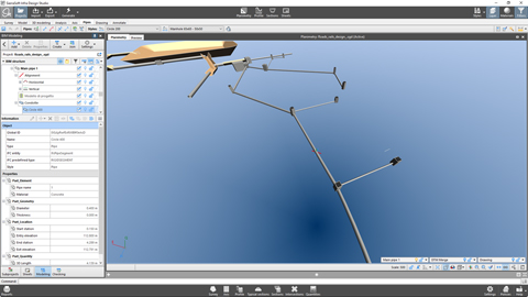
BIM object remapping with SierraSoft BIM Modeling
Example of remapping a bridge (vidéo en anglais)
Voir la vidéo >
Production of the information model of a pipe network with SierraSoft BIM Modeling
Example of creating an information model of a pipe network (vidéo en anglais)
Voir la vidéo >
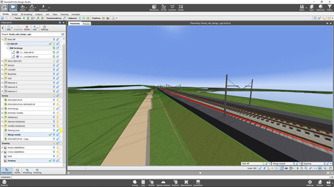
Production of a railway information model with SierraSoft BIM Modeling
Example of creating an information model of a railway (vidéo en anglais)
Voir la vidéo >
Production of a road information model with SierraSoft BIM Modeling
Example of creating an information model of a road (vidéo en anglais)
Voir la vidéo >
Production of a map information model with SierraSoft BIM Modeling
Example of creating an information model starting from a drawing map (vidéo en anglais)
Voir la vidéo >
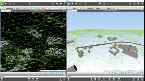
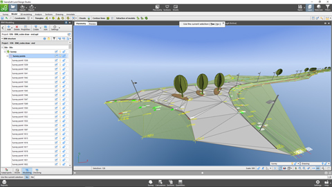
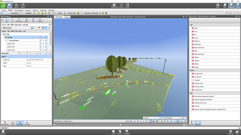
Production of a survey information model with SierraSoft BIM Modeling
Example of creating a survey information model (vidéo en anglais)
Voir la vidéo >
The road and railway infrastructure designer in BIM: evolution of a profession
Speech by Mauro Coletto (SierraSoft) - ASSOBIM Talks of 18 may 2023
Voir la vidéo >
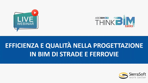
Efficiency and quality in BIM design of roads and railways
Speech by Mauro Coletto (SierraSoft) - ASSOBIM Talks of 14 December 2022 (vidéo en italien)
Voir la vidéo >
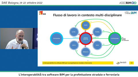
Interopérabilité entre les logiciels BIM pour la conception des routes et des voies ferrées
Speech by Mauro Coletto (SierraSoft) - Digitization Village by Assobim - SAIE 2022 (vidéo en italien)
Voir la vidéo >
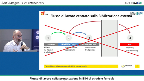
BIM workflow in the design of roads and railways
Speech by Mauro Coletto (SierraSoft) - Digitization Village by Assobim - SAIE 2022 (vidéo en italien)
Voir la vidéo >
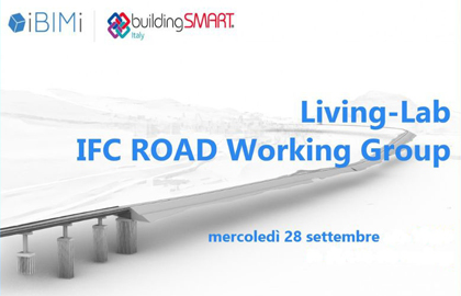
Living-Lab groupe de travail IFC Road
Présentation du “Guida all'IFC per il progetto stradale” résultant des activités du groupe de travail IFC Road de IBIMI - buildingSMART Italia (vidéo en italien)
Voir la vidéo >
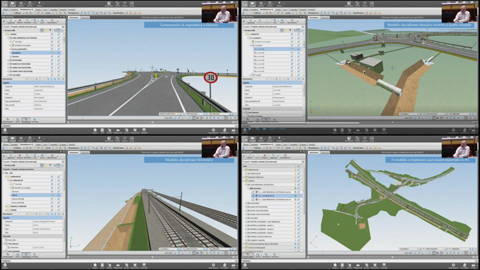
Modélisation de l'information des routes et des voies ferrées en IFC avec SierraSoft Infra Design Studio
Speech by Mauro Coletto (SierraSoft) during the 5th National Conference of IBIMI - buildingSMART Italia (vidéo en italien)
Voir la vidéo >
The design of road infrastructure with IFC
Speech by Mauro Coletto (SierraSoft) during the 4th National Conference of IBIMI - buildingSMART Italia (vidéo en italien)
Voir la vidéo >
Open exchange formats for road infrastructure modeling
Speech by Mauro Coletto (SierraSoft) during the 3rd National Conference of IBIMI - buildingSMART Italia (vidéo en italien)
Voir la vidéo >
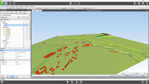
Logiciel BIM pour la modélisation 3D et l'analyse du territoire
SierraSoft Land est un logiciel BIM pour la modélisation 3D et l'analyse du territoire à partir de points levés avec station totale, GPS, scanner laser, drones.
Traditional land restitution and BIM with SierraSoft Land
Example of automatic BIM restitution of a survey using codes assigned in the field during measurement (vidéo en anglais)
Voir la vidéo >
Modeling and BIM quantity with SierraSoft Land
Modeling example, sections extracting and quantities calculation (vidéo en anglais)
Voir la vidéo >
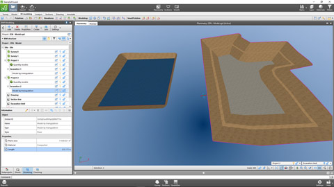
3D design in BIM with SierraSoft Land
Example of 3D design with smartpolyline, quantities calculation and models merging (vidéo en anglais)
Voir la vidéo >
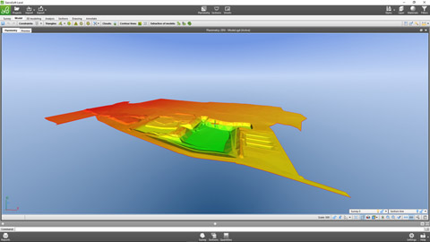
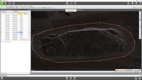
Point clouds management with SierraSoft Land
Example of modeling and quantities calculation on point clouds (vidéo en anglais)
Voir la vidéo >
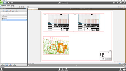
Final drawings in BIM with SierraSoft Land
Data printouts and management of annotations boxes and sheets for the creation of final drawings with the link to the project information model (vidéo en anglais)
Voir la vidéo >
Logiciel BIM pour la conception hydraulique
SierraSoft Hydro is a BIM software for hydraulic design of waterways, canals, ditches, pipes, pipe networks and manholes.
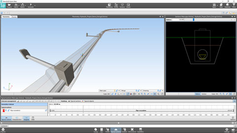
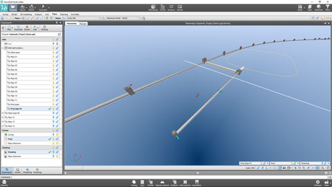
Hydraulic BIM design of a pipe with SierraSoft Hydro
Example of designing a hydraulic pipe below a road (vidéo en anglais)
Voir la vidéo >
Pipes networks with SierraSoft Hydro
Example of creating a pipes network and automatic numbering management (vidéo en anglais)
Voir la vidéo >
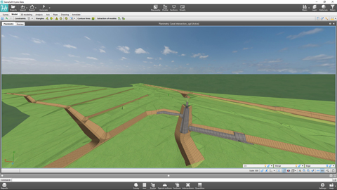
BIM design of canals with SierraSoft Hydro
Example of creating a new canal (vidéo en anglais)
Voir la vidéo >
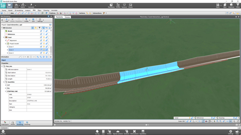
Canals and intersections customizations with SierraSoft Hydro
Examples of point changes to the canal axis and management of intersections with a network of existing canals. (vidéo en anglais)
Voir la vidéo >
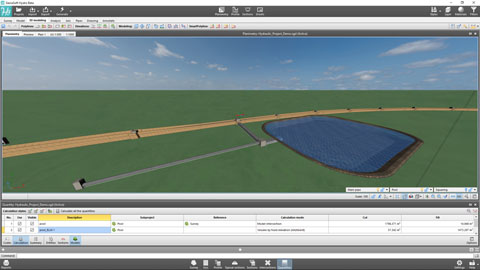
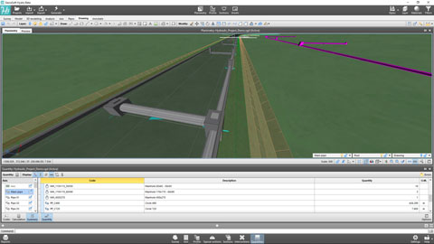
Quantities calculation in BIM with SierraSoft Hydro
Examples of quantities calculation for sections, on models and by entities with information model creation (vidéo en anglais)
Voir la vidéo >
Final drawings in BIM with SierraSoft Hydro
Data printouts and management of annotations boxes and sheets for the creation of final drawings with the link to the project information model (vidéo en anglais)
Voir la vidéo >
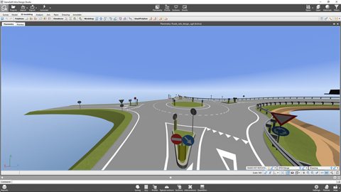
Logiciel BIM pour la conception de routes et d'autoroutes
SierraSoft Roads is a BIM software for the design of road infrastructure: roads, highways, roundabout, junction, intersection, entry/exit lane.
Designing of a road alignment according to the policy with SierraSoft Roads
Example of alignment design of an axis according to the policy (vidéo en anglais)
Voir la vidéo >
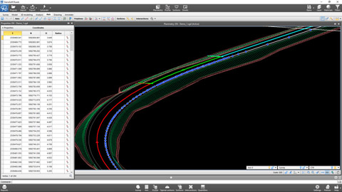
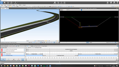
Axis generation and results with SierraSoft Roads
Example of axis generation to obtain the project planimetry, road model, sections, quantities and information model (vidéo en anglais)
Voir la vidéo >
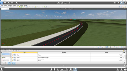
Quantities calculation in BIM with SierraSoft Roads
Examples of quantities calculation for sections, on models and by entities with information model creation (vidéo en anglais)
Voir la vidéo >
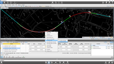
Customizing the alignment with SierraSoft Roads
Examples of modifications in specific axis points with typical sections, typical section characteristics, axis and profile polylines (vidéo en anglais)
Voir la vidéo >
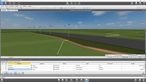
3D design in BIM with SierraSoft Roads
Example of 3D design with SmartPolyline and creation of the final model (vidéo en anglais)
Voir la vidéo >
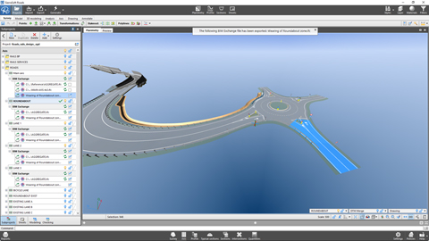
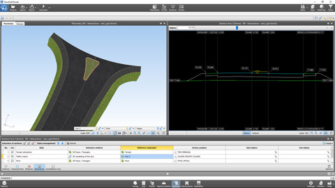
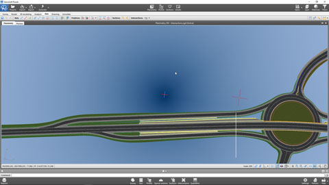
Managing intersections in BIM with SierraSoft Roads
Example of management of at-grade intersections, at-grade roundabout and entry/exit lane (vidéo en anglais)
Voir la vidéo >
Final drawings in BIM with SierraSoft Roads
Data printouts and management of annotations boxes and sheets for the creation of final drawings with the link to the project information model (vidéo en anglais)
Voir la vidéo >
Logiciel BIM pour la conception de voies ferrée
SierraSoft Rails is a BIM software for the design of railway infrastructure for low and high speed, single and double track.
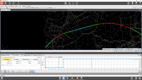
Designing of a railway alignment according to the policy with SierraSoft Rails
Example of alignment design of an axis according to the policy (vidéo en anglais)
Voir la vidéo >
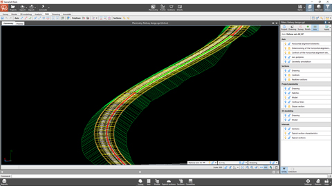
Axis generation and results with SierraSoft Rails
Example of axis generation to obtain the project planimetry, railway model, sections, quantities and information model (vidéo en anglais)
Voir la vidéo >
Customizing the alignment with SierraSoft Rails
Examples of modifications in specific axis points with typical sections, typical section characteristics, axis and profile polylines (vidéo en anglais)
Voir la vidéo >
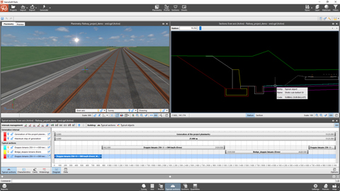
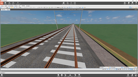
3D design in BIM with SierraSoft Rails
Example of 3D design with SmartPolyline and creation of the final model (vidéo en anglais)
Voir la vidéo >
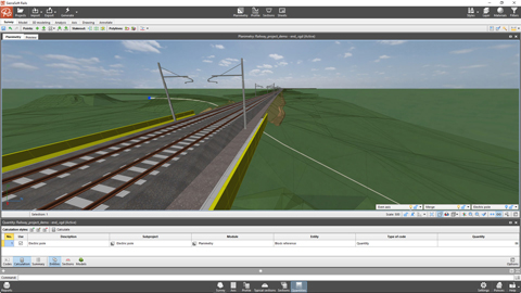
Quantities calculation in BIM with SierraSoft Rails
Examples of quantities calculation for sections, on models and by entities with information model creation (vidéo en anglais)
Voir la vidéo >
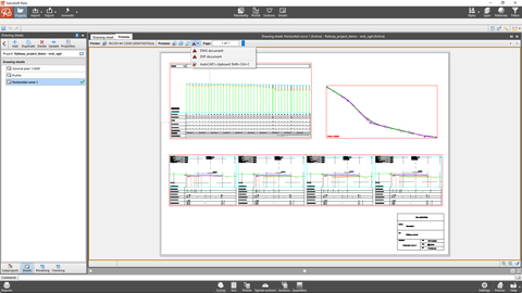
Final drawings in BIM with SierraSoft Rails
Data printouts and management of annotations boxes and sheets for the creation of final drawings with the link to the project information model (vidéo en anglais)
Voir la vidéo >